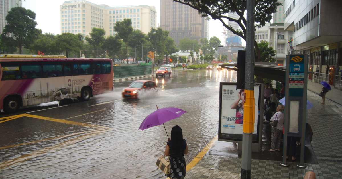
Make sure to pack an umbrella in your bag as part of your “must-have essentials”, because we’re going to be experiencing a few wet months.
The causes?
Two weather phenomena with the tendency to bring rainfall happening at the same time, called La Nina and the Indian Ocean Dipole.
What is La Nina?
If La Nina seems to strike a chord within you, like you’ve heard or seen the phrase before but don’t know when or where, chances are, you probably have.
Firstly, it is not a natural disaster of some sort. What’s with people and giving disasters female name denominations anyway?
If this is a period joke, centuries in its making, feminists will need to dig some graves to kick the literal crap out of piles of bones.
Rather, La Niña, which translates to “the girl” in Spanish, refers to an oceanic and atmospheric phenomenon wherein the sea surface temperature across the east equatorial part of the central Pacific Ocean is lower by three to five degrees Celsius.
It occurs every two to seven years, and it affects the Southeast-Asian region by bringing above-average rainfall and flooding.
The current La Nina episode began in 2020 and is predicted to end around 2023 instead.
Our blue cat said it was going to end soon, but it can predict the weather wrongly sometimes.

Most of us aren’t Geography experts, so think of the ocean like… a dirty table surface being wiped clean by wind to reveal a clean and cooler surface.
The analogy is weird but stick with me.
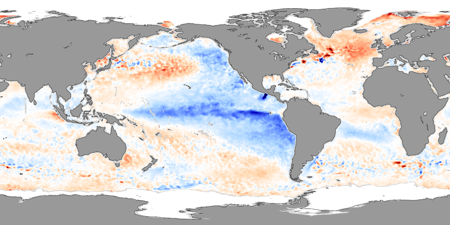
When strong winds blow the “dirt”, by which I mean the warm surface water, away from South America, across the Pacific Ocean and towards Indonesia, the cold water from the deep sea rises to the surface.
This causes the temperature of the Pacific ocean to drop, which makes everything near the region wetter and colder.

The image above shows the temperature anomalies from the La Nina of 2007, where tongues of colder water are visible on the sea surface temperature maps.
Who needs explanations when you have nice maps?
La Nina is also part of the greater El Niño–Southern Oscillation (ENSO) climate pattern, where La Nina and El Viejo—characterised by its higher surface sea temperatures in contrast—consistently alternate.
What is India Ocean Dipole?
The second weather phenomenon simultaneously at work is called the negative phase of the Indian Ocean Dipole (IOD), which also makes the weather ripe for rain.
Similar to the ENSO climate pattern in the Pacific Ocean, the Indian Niño is, quite literally, the exact same thing, but for the Indian Ocean, though it’s much more irregular.
The IOD goes through an aperiodic oscillation of sea-surface temperatures, depending on the wind direction, going through either a positive, negative, or neutral phase.
The Indian Ocean is much more “hormonal” than the Pacific, I guess.
There are temperature patterns in the Indian Ocean, and meteorologists have done a great job marking the changes ever since the tracking technology has been made available to mankind, but it’s definitely more erratic than ENSO.
When the IOD is positive, the western Indian Ocean region will experience higher-than-average sea-surface temperatures and greater precipitation, while the east side cools.
When the IOD is negative, the exact opposite happens; the western Indian Ocean will have cooler and drier conditions, while the east gets warmer water and greater precipitation.
The Southeast Asia region is, well, located in the East.
Which means the warmer waters that are brought towards the Southeast Asia region and Australia by intensifying winds along the equator provide an abundance of energy and moisture to form rain clouds.
When the two weather phenomena clash, they will only fuel each other.
Brace yourselves, because it’ll be a couple wet months.
If we still believed in myths, whatever weather gods are out there are just having a competition to see who can be the greatest divine waterfall.
Why is Everything so Wet?
Besides La Nina and the negative IOD happening concurrently, there’s a third and fourth factor to account for.
The third being the monsoon seasons.
The south-west monsoon season, which happens from June to September, tends to intensify the effects of La Nina, thus causing a higher-than-average rainfall.
The fourth factor that exacerbates the effects of the weather phenomena is human induced climate change.
According to the Secretary-General of the United Nations World Meteorological Organisation, Professor Petteri Taalas, he noted that global warming and climate change is amplifying the impact of these naturally occurring events.
This signifies that we’re more likely to face record-breaking torrents of rainfalls and floods when weather phenomena coincide, and on the flip side of things, we’re also more likely to face intense heat waves and droughts when the weather patterns flip.
What Does This All Mean For Singapore?
Unless you’re fond of walking in the rain—which can genuinely a nice experience—make sure you’re always armed with an umbrella for the next two months or three.
… You don’t have to worry about your waterproof phones anymore, but your other stuff might not survive the rain.
While the constant rainfall will have a cooling impact on the region, easing the warm and humid conditions that have tormented us through April and May, the temperature drop won’t be as significant as one might hope.
The Meteorological Service Singapore (MSS) forecasted that the daily temperatures will range from 24°C to 33°C, which sounds like natural air-con bliss to tolerable conditions.
However, there might still be a few warm days where the highest temperature of the day could exceed 34°C.
Nonetheless, any rain and colder temperatures are always welcome in tropical Singapore.
Featured Image: Shuttershock / Christian Heinz
